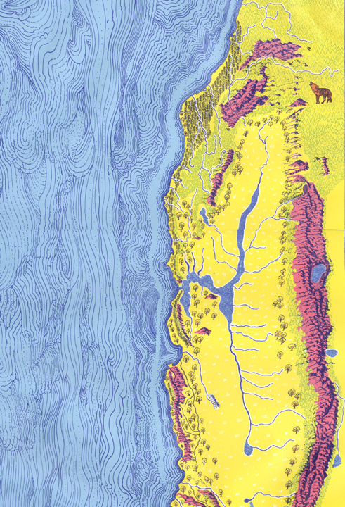
Looking at the Okamura-Breedlove map, and speculating about the area that it represents, I am aware that I am looking at a picture of home. I’ve been over and around and across and through most of it at one time or another. It’s really a map of coyotes and billy owls, hawks circling in the sky, oak trees, chamise, sun-scorched grass and dripping wet forests. It is easier to write about the land than about a map. But the map is good. It shows where things are, or where they were. So much has changed, and the changes go on. Most of those blue inland waters aren’t there any more, and there is a new pattern of blue lakes, backed up behind the big dams.
There is a question of boundaries – do they make any sense? The Sierra Nevada is obvious, whether one draws the line along the top, which is geographically neat, or farther down the east slope to where the juniper, pinyon, and sagebrush take over. Beyond that you are in Great Basin country. It may legally be part of California, but biotically it is somewhere else. To the south, one had just as well follow the boundary offered by the Tehachapi Mountains and exclude the desert country to the south. It belongs more to Sonora than to California. Toward the coast, however, the situation is more confused. Biotically there are broad ecotones, areas of overlap or gentle gradation. Still I’d be happy to draw the line along the Santa Maria and Cuyama Rivers, then up to the top of the Tehachapis, and let the rest go south. After all, most of the people south of that line think of Los Angeles as “The City”, and they deserve to go with it.
Up north one can follow the Sierra-Cascade axis on the east. Mount Shasta is California’s magic mountain and must remain with the whole. Toward the coast, boundaries and skies get foggy – one can follow the redwoods into Southern Oregon, and obviously one must keep the Siskiyou Mountains as a unit. Wherever the line is drawn, Oregonians will be offended, and the biological arguments grow vague.
In my own map drawing I have indicated that there is one uniqueCalifornia biotic province. Unfortunately for this argument it excludes the California north coast but takes in coastal Southern California and a part of Mexico. The other biotic provinces which enter the political boundaries of the state have their real enters outside of the state: Oregonian on the coast, Sierra-Cascade, Great Basin and Sonoran. Still, we would do better to talk about sub-provinces or biotic districts. The Sierra is not the Cascades, and there is a clear distinction between the California redwood sub-province and all areas that lie to the north.
All considered, the map represents a reasonable distinct piece of country. One can identify with it. It has its sink in San Francisco Bay, toward which much of its water flows, and in the surrounding cities, toward which much of its energy flows. It is being tapped and drained in a colonialistic manner by the great mass of people who live south of the Tehachapis.Ecologically it is unique – not like anything elsewhere in the Americas, not like any place else on earth.
The Pacific Rim
Call it Northern California, call it the State of Shasta, what we are talking about is a state of diversity, more diversity than you can find in any area of similar size in North America. The diversity is in the animal life, the plant life, the topography, and in the people. Maps can’t show it, photographs are inadequate, one must experience it.
It starts with the North Pacific from which the big waves sweep in to batter the westernmost point of land at Cape Mendocino, or surge around the lonely rocks of the Farallones. Take a calm day when the tide is low and explore the rocks and tide pools in some area protected from pillage and not too drowned in human effluents. Look closely and long, for here is the first encounter with animal diversity – sea mussels, barnacles, limpets, periwinkles, sea urchins, anemones, chitons, moon shells, olive shells. Enough protein grows here to keep a reasonable number of people well nourished , enough shell to keep them adorned. But numbers are no longer reasonable, and the life that lives between the tides must be cared for and guarded against the ravages of millions.
On the stacks and islets of the coast the sea mammals haul out to lie in the sun: the California sea lion and its larger relative, the Stellar se lion, along with harbor seals are the most common, but the elephant seals and fur seals are slowly reinhabiting the California coast. The remarkable sea otter is also to be found, an animal loved by everyone except abalone fishermen. Sea birds are numerous and impressive. Gulls are the spirit of the coast, but cormorants and murres form massive breeding colonies on some offshore islets, and notably on the Farallones. Most striking are the brown pelicans, now beginning to recover from their long bout of DDT poisoning. Once the sea birds could produce enough eggs to keep coastal Indians supplied, and still maintain their own numbers. But that was in the past, or in the future.
It is the land and its life that I am mostly concerned with and it starts here on the shore. Most of the coast is rocky and formidable – most strikingly where the Santa Lucia mountains or the King Range meet the sea. There may be a small cove here and there with a patch of sandy beach, but beaches are not typical of California. Mostly there are coastal cliffs, and at their tops, above the reach of splash and spray, the coastal vegetation begins. It takes the form of coastal sagebrush, or the taller denser coastal scrub, or of high coastal forest, but in some areas grasslands replace the wood plants.
The Coastal Forests
The coastal forest is the home of the redwood, that tree which can only be described in superlatives. It grows naturally only in the region we are describing – from the Chetco River on the Oregon coast to its southern outpost on Salmon Creek in the Santa Lucia mountains. Although it occurs close to the sea in some areas, the redwood is most at home in sheltered coastal canyons, and along the flats of the big coastal rivers – the Smith, Klamath, Mad, Eel and Russian in particular. After more than a century of hammering from the lumber industries most of the old-growth redwood forests have gone, except where belated intervention has protected them in state parks, or the inadequate Redwood National Park. Yet redwoods survive well in the second-growth forests which have come in to replace the old growth. They are a tough and resistant species when growing in their home territory, and one need not fear for the survival of the redwood species, as such. But a thousand-year-old forest is a unique phenomenon, a holy place, and it takes a thousand years to grow one.
In the north of our region the coastal fringe of forest is more commonly occupied by Sitka spruce and lowland fir, trees that have their greatest abundance north of California. But there are some unique species to be found other than redwood. One of these is the Bishop pine which forms fascinating forests in the Point Reyes-Tomales Bay area – misty, mossy forests that belong in mythology and not to the late twentieth century. Indeed the Bishop pine does belong to an older world when coastal California extended outward into what is now the seas. In its distribution it occurs in patches along the coast from Fort Bragg down to the southern Santa Lucias, but then is found again along the coast of Baja California and out on Cedros Island. These are remnants from a wider distribution during some more favorable climatic period.
Even more patchy in its coastal distribution is the Monterey pine, which survived from the past only in a few groves – near Santa Cruz and Monterey, and farther south at Cambria – then leaps to the islands of the Santa Barbara channel, and still farther to remote Guadelupe, far off the coast of Mexico. Surviving so precariously in its homeland, the Monterey pine in the hands of foresters was to take over much of the world. Today its greatest abundance is in the forest plantations of Australia, New Zealand and South Africa. Here at home it is appreciated for its beauty, not its timber.
All forests that grow near the coast tend to become twisted, grotesque and strange. Often the crowns of trees will be wind-sheared and interlaced to form a totally closed canopy. Among the stranger ones are the beach pine forests that grow from Point Arena to the Smith River in those few places where there are coastal dunes. Here they form a climax, or near-climax forest in the more sheltered and stabilized areas. Where the dunes are marching inland, pushed by the northwest winds, the struggle between the stabilizing influence of the forest and the life-smothering drive of the blown sand goes on. Where the dunes win and then move on, a ghost forest emerges once more in the dune swales – while twisted trunks, some still carrying the cones they bore in their final year of life. The taxonomists tell us these beach pines belong to the same species as the tall straight lodgepole pines of the high mountains. A species can be a confusing entity.
All of the coastal forests are laced together by their undergrowth – by huckleberries, salmonberries, salal, rhododendron, or by the great ferny jungles that clothe the moister areas or on the ground by trilliums and Oregon lilies, coltsfoot, redwood sorrel, Solomon’s seal and wild ginger. This is where the food for ground-dwelling animals is to be found, and for thousands of years, food for people also. Where fire or storm has created openings, or along the banks of rivers, the understory shrubs form dense thickets. These are the places that support the black-tailed deer and black bear. In the old-growth forests ground-dwelling mammals are not abundant. Shrews and moles that feed on insects, yes, but the mice and brush rabbits, and the carnivores that feed on them, prefer the open areas. Hunters of the past and present learn to seek out the burns, where lightning-or-man-caused fires have opened the woods and fertilized the ground with ashes bearing nutrients that had been locked up for centuries in tree trunks. Higher in the trees, however, a moderate abundance of arboreal mammals – chickarees and flying squirrels, and the strange red tree mouse – are to be found. Here too are the Stellar jays, livening up the forest scene, and usually somewhere overhead one can see circling that dark forest spirit, the raven.
The larger animals of the coastal forest region have not fared well. Once herds of Roosevelt elk grazed the open glades as far south as Point Reyes, and perhaps farther. We don’t know where the Roosevelt elk left off and the smaller tule elk of the interior valleys began. Now, there is no question. The Roosevelt elk held out only in the more remote coastal areas of Humboldt and Del Norte counties, reaching its greatest abundance in the area around Prairie Creek. It is coming back, but slowly. The tule elk barely survived. It could come back, but farmers and ranchers prefer that it does not.
The California grizzly bear, once present in large numbers along the coast, now survives only in memory. Californians honor it on their Bear Flag, but they killed every last one. Those other arch-predators, the cougar and the wolf, were also made to feel unwelcome. The cougar learned to control its curiosity and keep out of sight of mankind. It survives.
Most of the coastal fringe of California is not covered by tall forests but by lower growth the coastal scrub or “soft chaparral” dominated by coyote brush, or in some places by the shrubs from the forest understory, usually with a high percentage of poison oak and wild blackberries. In more exposed sites this dwindles to a lower growing coastal sagebrush in which the soft-leaved California sage mingles with the true sages (Salvia) and sometimes wild buckwheat. Where fires have burned too often, or perhaps just where the wind blows too steadily and too hard, grasslands take over.
The coastal grasslands of California, while faring better than those of the interior, still are little like the fields that received the first Spanish livestock. Where once tall perennial bunch grasses dominated the scene, now, for the most part, there are annual grasses brought from the European fields and pastures. Wild oats, barley grasses, annual bromes have taken over from the perennial fescues, needlegrasses and oatgrasses. Still, it has been shown in these moister coastal prairies, with a little good management, something resembling the former scene can be restored. Meanwhile the California poppies can turn hillsides to gold and lupines can carpet the valleys in blue. Given a chance the wild things return.
Chaparral, Woodland, and Broad-leaved Forest
Without putting down the importance of the coastal conifers and their associates, the most typical vegetation of California is of a different nature. Plant ecologists call it a broad-sclerophyll, meaning that trees and shrubs tend to have broad, hard leaves—often waxy or hairy on the surface—adapted to withstand the long summer dry season of their homeland. This is vegetation which, in its forest form, is characterized by evergreen oaks (Quercus), tanoaks (Lithocarpus), laurels (Umbellularia), and the strange, red-trunked madrones (Arbutus). The shrub form, which is more widespread, is the chaparral, dominated by species which most people outside of California do not know—the red-barked, twisted manzanitas (Arctostaphylos), and the wild lilacs (Ceanothus), both represented by great numbers of species which blend with the scrubby species of oak, or give way, particularly in the foothills and valleys, to an open savanna, the woodland-grass where deciduous blue oaks or white oaks are scattered in what was once a bunchgrass prairie, but is now mostly replaced by farm lands or pastures.
If one genus of woody plant can be said to characterize California it is the oak genus. Oak trees range throughout the state, from the tall black oaks and canyon oaks of the mountains, through the blue oaks of the foothills, the white oaks of the valleys, to the shiny evergreen live oaks of the coastal area. All produce acorns, and for the original inhabitants of California acorns were the staple food—the wild equivalent of corn, wheat or barley. The face of the state is changed by human activity. The oak trees remain, ready to come back when given half a chance.
There is not much old-growth sclerophyll, or broadleaved evergreen forest in Californnia, but what there is has a mythic quality. It should be the home of Druids. One could expect to meet fauns or dryads. The trees belong to illustrations of Arthurian legend or to the world of Tolkien. Or so it seems to me. Others wonder how to get rid of them to get more pasture. You understand, they contribute little to the commercial economy. They just help hold the hills together.
Chaparral is widespread in Northern California, from the foothills of the Tehachapis up through the Coast Ranges, or along the lower slopes of the Sierra, with both belts joining at Mount Shasta. It is maintained by fires, which continue to burn in one place or another despite all efforts at prevention. Chaparral fires are now frightening phenomena, for the brush has growth tall and dense in many places. Whole hillsides seem to explode as fires move with the wind in the hot dry days of summer. Yet, following the fire the hills turn green with herbage when the rains come in the fall. For every shrub whose crown is killed by fire, scores of shoots or seedlings spring up from root crown or seed. The new, sprouting brush supports great numbers of deer and other browsers. Deer populations may grow to a hundred or more per square mile. Then, as the brush grows older the food value declines, deer begin to die off or to produce fewer surviving fawns. But another area burns and there the deer will increase again. Where deer become abundant, and people do not intervene, all the animals that feed on deer can also increase – mountain lions and bears, coyotes, bobcats, and the lesser species who like a bite of meat.
It is said that when the Indians controlled the land, the chaparral did not grow so tall and dense, and wild fires were not so menacing. A program of light burning in spring and fall can keep the brush open and allow a carpet of grass to spread among the shrubs. The result is an open shrub-land in place of closed chaparral, more favorable to a reasonably stable population of deer and to a variety of other wild animals. No doubt this condition was maintained in some areas by the Indians, but it is doubtful that all brush fields could be kept open. Some early accounts tell of tall chaparral with trails that were “tunnels in the brush.”
The Central Valley
The Central Valley supported the greatest abundance of wildlife. Into what is now the dry San Joaquin Valley in the south, the rivers of the southern Sierra once poured their flood waters in the spring to form large shallow lakes – Buena Vista and Tulare Lakes – of which only traces remain. Surrounding the lakes were marshlands from which waters drained into the broad channel of the San Joaquin River. There they flowed northward fringed by tule swamps, into the more extensive marshlands of the delta, providing a home for the golden beaver of the valley and for the waterfowl. This was then the Tulare or Tule Valley, named from the tall reeds of tules that were the most characteristic species of the marshes.
The abundance of waterfowl was fantastic – ducks, geese, and swans by the millions, equaled by the numbers of shore birds and wading birds. Great echelons of waterfowl moved north to the Arctic each spring, but left behind a teeming variety of species which bred in the valley wetlands. In the autumn once more the air was filled with the sound of the migrants returning to their winter home.
Above the marshes in the oak-dotted savannas or open prairie were herds of tule elk and pronghorn with scattered bands of deer. Over them flew the giant condors waiting to feed on those which had been killed by grizzly, cougar, or coyote.
The change began as Spanish cattle moved into the valley. The change accelerated when the Anglos came to clear and drain off the flowing rivers. Survivors of the onslaught remain but nowhere in their old abundance. Now the lands support the field crops and orchards, cotton and grain fields of a different culture, and most cannot believe that the old Tulare Valley once existed.
The Sacramento Valley in the north was not so damp or spongy. Here the river banks were fringed with riparian woodlands which included many of the broad-leaved deciduous trees whose relatives form the forests of eastern America. On higher ground were the prairies and oak savannas with their deer and elk and antelope. Here too the original diversity has been supplanted – first by domestic animals, then by farmlands. Here the big dams have also been placed on all but the smaller streams, and the flow into the valley is diverted and controlled.
The Life of the Mountains
In the Sierra Nevada, the high ranges of the north coast, and in smaller areas elsewhere, coniferous forest takes over from the chaparral and oak woodland. The dividing line seems to be the 30-inch annual rainfall belt, more or less. The lower belt of conifers is what C. Hart Merriam has called the Transition Life Zone. It is dominated by the ponderosa pine, the most numerous species of pine in western America – which, where given a chance, can grow 200 feet high and reach 8 feet in diameter. These are joined by incense cedar, white fir and black oak. Above the ponderosa belt one enters the mixed conifer forests when sugar pines, often larger and taller than ponderosa pine, become common and where the Douglas fir may dominate in more sheltered areas. This is the zone also where the incredible Big Trees grown. These relatives of the coast redwood may reach over 20 feet in diameter and grow to more than 300 feet in height. These old ones were living before Rome or Carthage was thought of, at a time when civilization could have been nipped in the bud. They survive only in the Sierra, in scattered groves from the American River south to the Tule River.
At higher elevations the western white pine becomes more abundant. Here too red fir begins to take over and form pure stands. Lodgepole pine also forms pure stand at these elevation, particularly surrounding meadow areas. Higher than this is the zone of timberline where one encounters wind-shaped mountain hemlock, twisted white bark or foxtail pines and Sierra junipers – trees that can survive under the most rigorous climatic regimes. Where these higher forests are opened up by fire, brush fields dominate, in which bitter cherry or the kind of Ceanothus called snowbrush often occupy large areas. Above timberline even the shrubs dwindle away to be replace by alpine fields, low-growing tundra-like plants, or scattered herbs that grow up to the limits where plants can survive.
Animal life in the mountains is in part migratory. Deer, for example, move each year from their summer ranges in high meadows or brush fields down the slope along the trails that they know to winter ranges below the level of winter snow pack, in the lower fringes of pine forest and the upper edges of the chaparral. Each deer herd has its favored wintering and summering grounds. On traditional winter ranges the number of deer can be impressive, but between these there will be gaps with similar vegetation and few deer. In winter the migrant herds encounter those deer who remain resident throughout the year at lower elevations. The numbers of these are fewer, since they commonly lack the nutritional advantages of the migrants, who follow each spring the line of freshly sprouting green herbage up the mountainside.
Where deer are abundant other migrating species will also be found, but not all species move downhill. Bears and many rodents will hibernate through the cold months in sheltered places, and emerge only with the warm weather of spring. Birds that feed in tree canopies on seeds or buds can remain high. The blue grouse, for example, will hide out all winter in a single fir tree, feeding on buds. One can find these grouse trees in the spring by the ring of droppings surrounding their trunks.
The life of the mountains has bee more resistant to the impact of an industrial culture than that of the lowlands, partly because of protective measures taken long ago. Many areas are designed as Wilderness Areas and are kept free from most disturbance. National parks occupy large areas of the Sierra Nevada, and have been long protected. Sequoia, Kings Canyon, Yosemite and Mount Lassen are all national park areas. More extensive, and covering most of the forested area of the Sierra and high Coast Ranges, are the national forests. Although these have been oriented too much toward timber production at the expense of other values, they still offer some security to mountain wildlife.
One can still get lost in the mountains, or go for long periods without encountering other people. It takes planning to manage this today, but it can be done. If the strange tales are true, and there is still a Sasquatch or “Bigfoot” living in the Siskiyou Mountains of the north coast, then the mountains are wilder than we think. I would like to think that there are, at least, still wolves and wolverines.